Norfolk and Suffolk: Where the possibilities are unlimited
We’re bringing together an inspiring line-up of businesses who are driving real change across investment, infrastructure, and sustainable growth in Norfolk and Suffolk. Join us in fuelling the world – meet us at UKREiiF to see what it’s like to invest here and be part of a dynamic, innovative and thriving economy.
Norfolk and Suffolk: Fuelling the World through Innovation, Productivity, Growth, and Investment
-
20th May 2025
-
3.30pm – 5pm
-
Newsroom Stage
Commercial
Opportunities
Explore the region’s investment and development opportunities in two ways – using the interactive resource map or browse the resources list.
Resource Map
Use the interactive map below to explore the region’s standout commercial opportunities — from strategic development land to high-potential properties. Filter the markers on the map by property type to find sites that match your ambitions. Click on each marker to view key details, images, and contacts.
Click here to skip the map and view the resources listed below.
Resource List
Use the resources list to explore the commercial opportunities across Norfolk and Suffolk. Each listing includes a visual preview and a direct link to more information. From development sites to innovation spaces, these resources connect you to the potential our region has to offer.
Norfolk
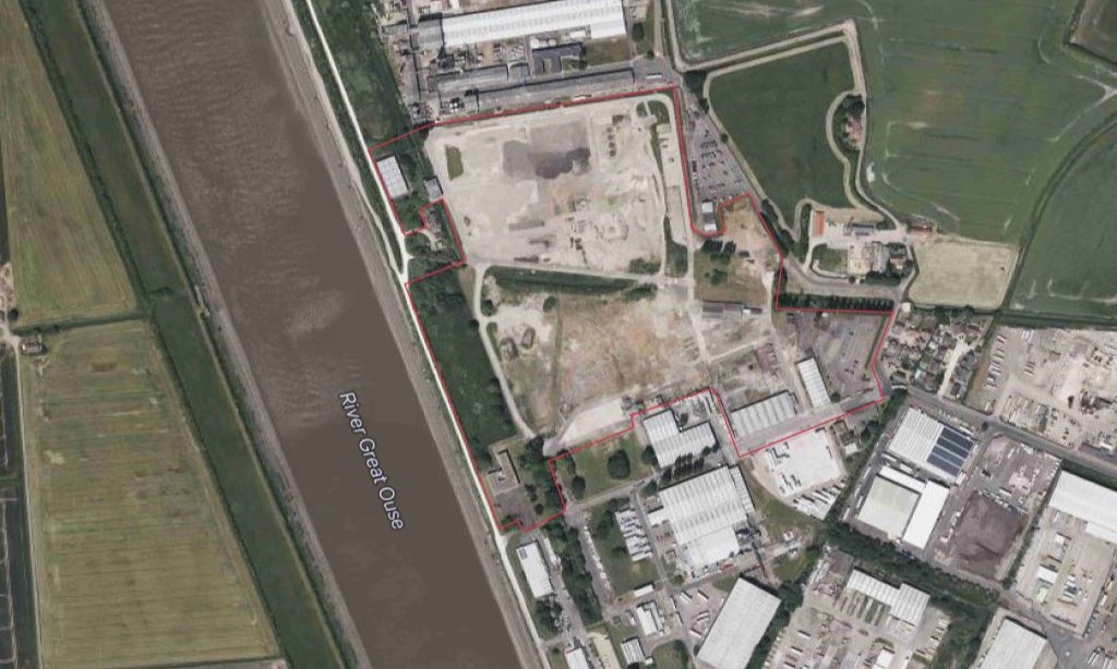
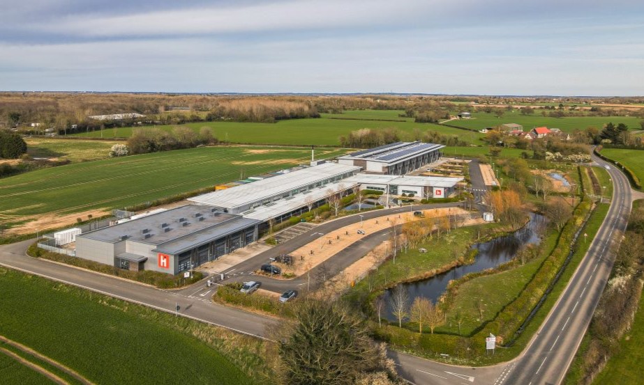
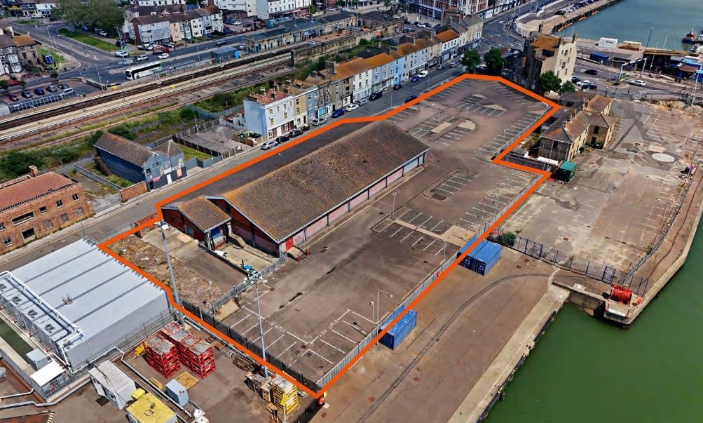
Sommerfeld & Thomas Warehouse and
Grain Silo Site
King’s Lynn, Norfolk
Download Sommerfield & Thomas PDF
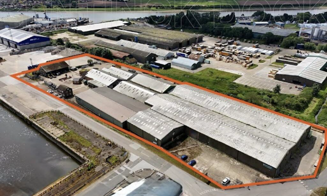
West Bentinck
Dock Site
Download
Bentinck Dock pdf
King's Lynn
Enterprise Park
King’s Lynn, Norfolk
Download
KL Enterprise Park pdf
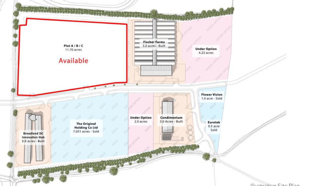
Corteva
Agriscience Site
Download
Estuary Road PDF
Food Enterprise Park
Visit Food Enterprise
Park Website
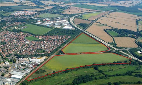
Browick
Enterprise Park
Wymondham, Norfolk
Visit Dencora Website
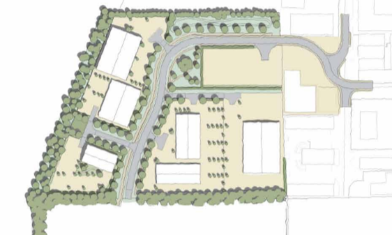
Diss Business Park
Download Diss
Business Park PDF
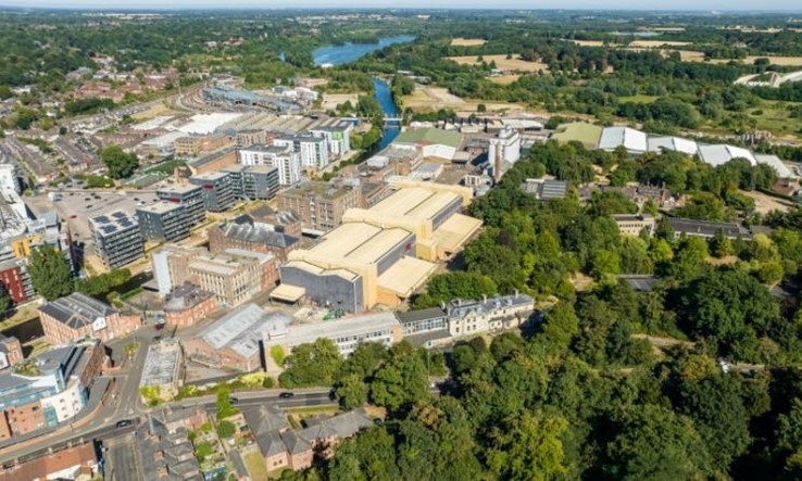
East Norwich
Download
East Norwich PDF
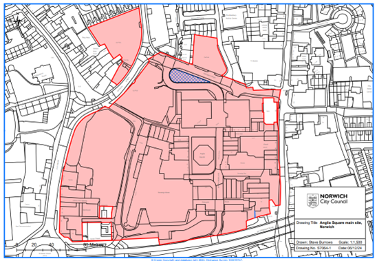
Anglia Square
Download
Anglia Square PDF
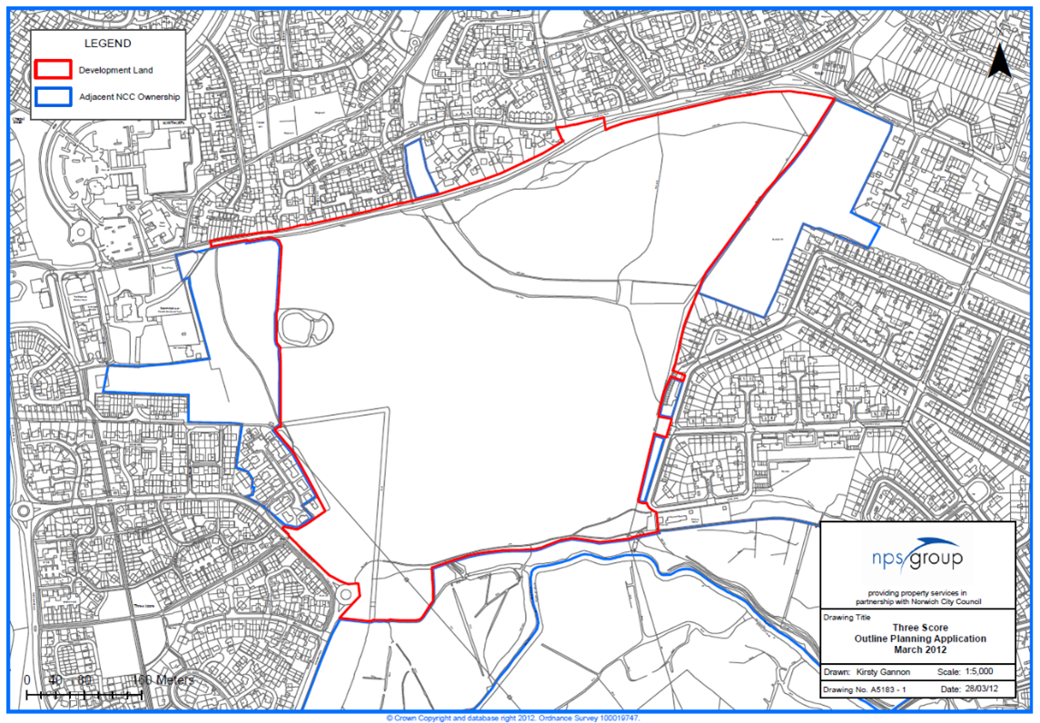
Three Score
Download
Three Score PDF
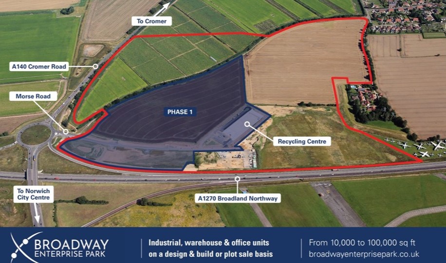
Morse Road
Download
Morse Rd PDF

City Hall
Download
City Hall PDF
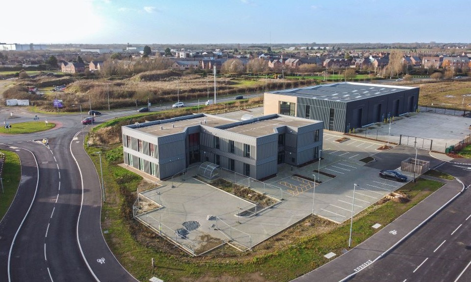
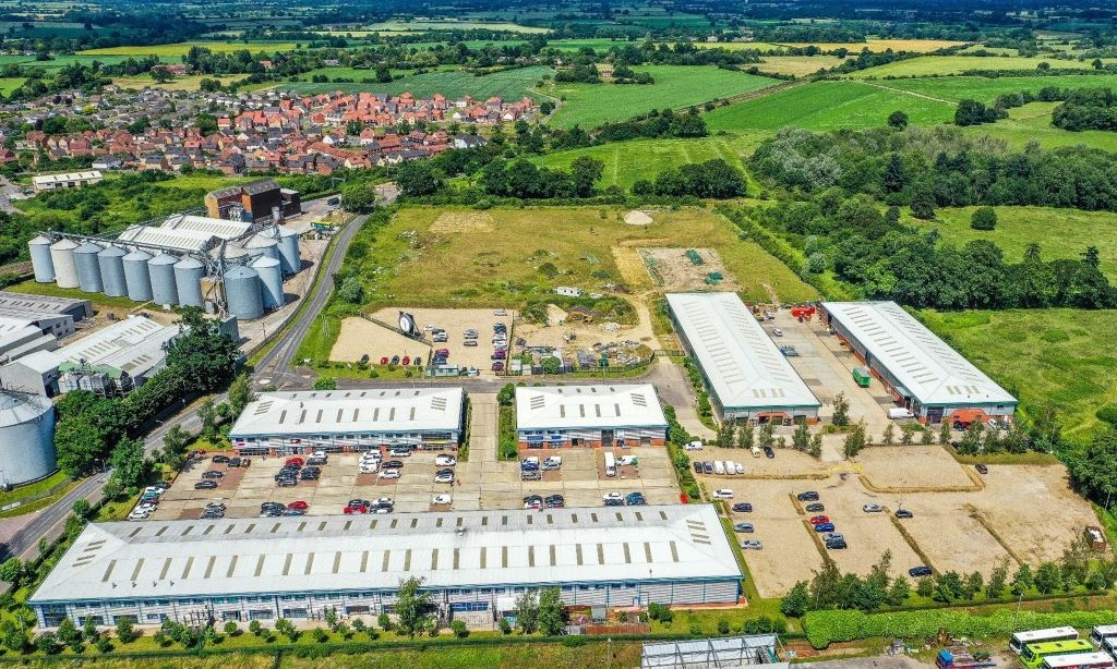
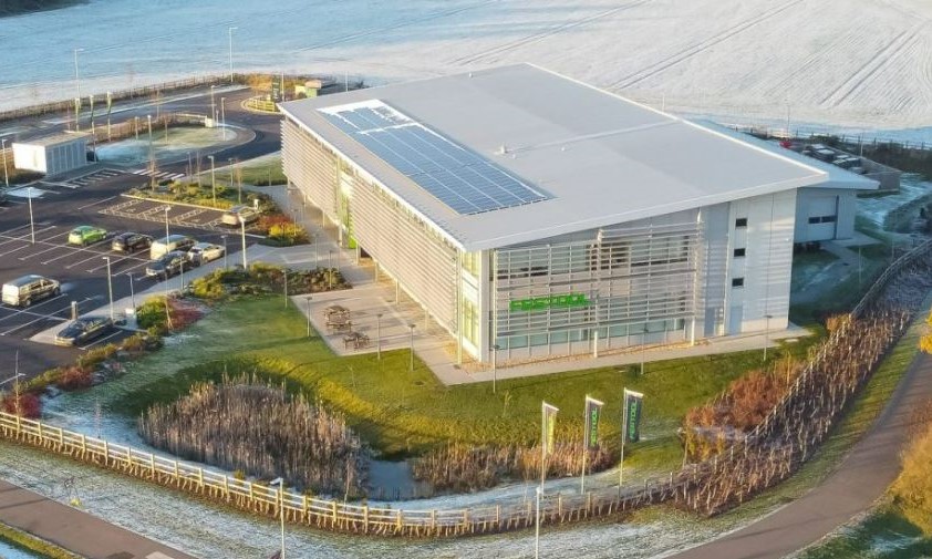
Hethel Engineering
Centre - Phase 4
Norwich, Norfolk
Visit Hethel Engineering
Centre Website
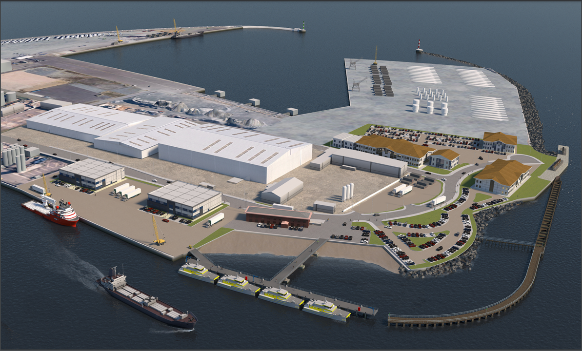
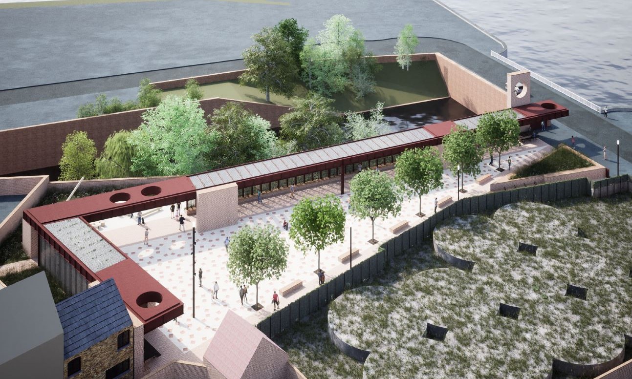
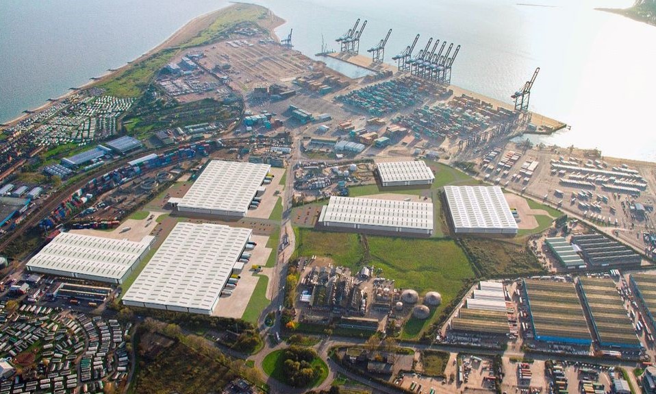
South Denes Offshore Energy Zone
Download
South Denes PDF
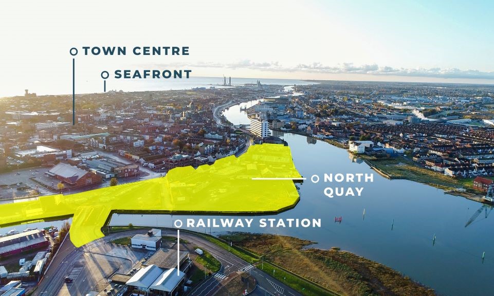
North Quay
Download
North Quay PDF
Beacon Business Park & Extension
Download Beacon
Business Park PDF
Suffolk
A & E Cooke
Farmers Ltd
Lowestoft, Suffolk
Download A&E Cooke Site Masterplan PDF
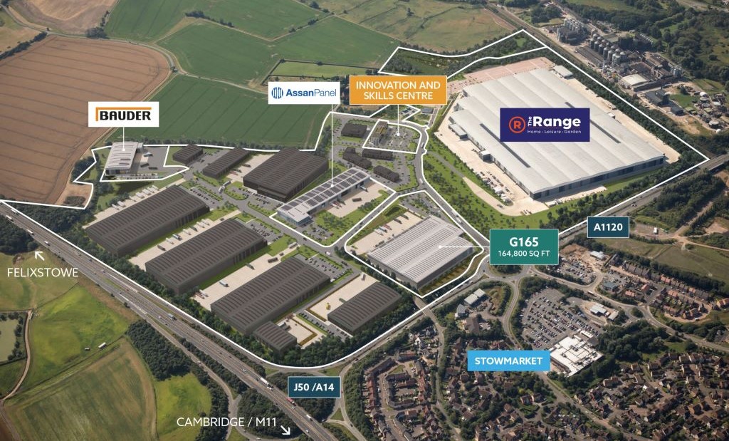
Felixstowe
Tax Site
Visit Freeport
East Website
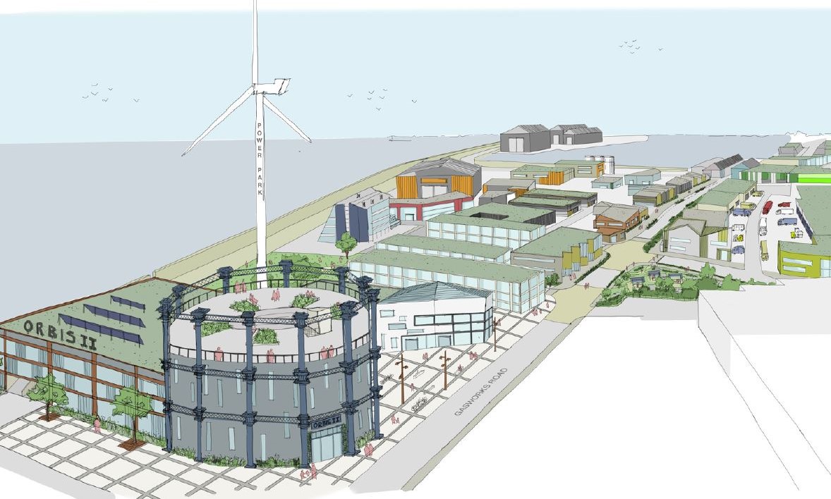
PowerPark
Lowestoft, Suffolk
Visit East Suffolk Website – Powerpark
Riverside
Download
Riverside PDF
Tower Road
Lowestoft, Suffolk
Visit Bycroft agent Website – Tower Rd
Wolseley
Business Park
Visit Wolseley
Business Park Website
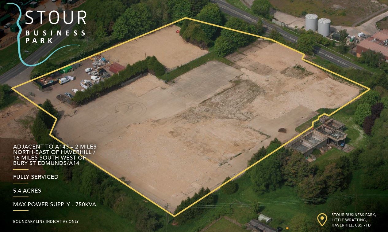
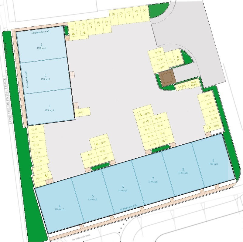
Stour Business Park
Download Stour
Business Park PDF
Stanton
Business Park
Visit Stanton
Business Park Website
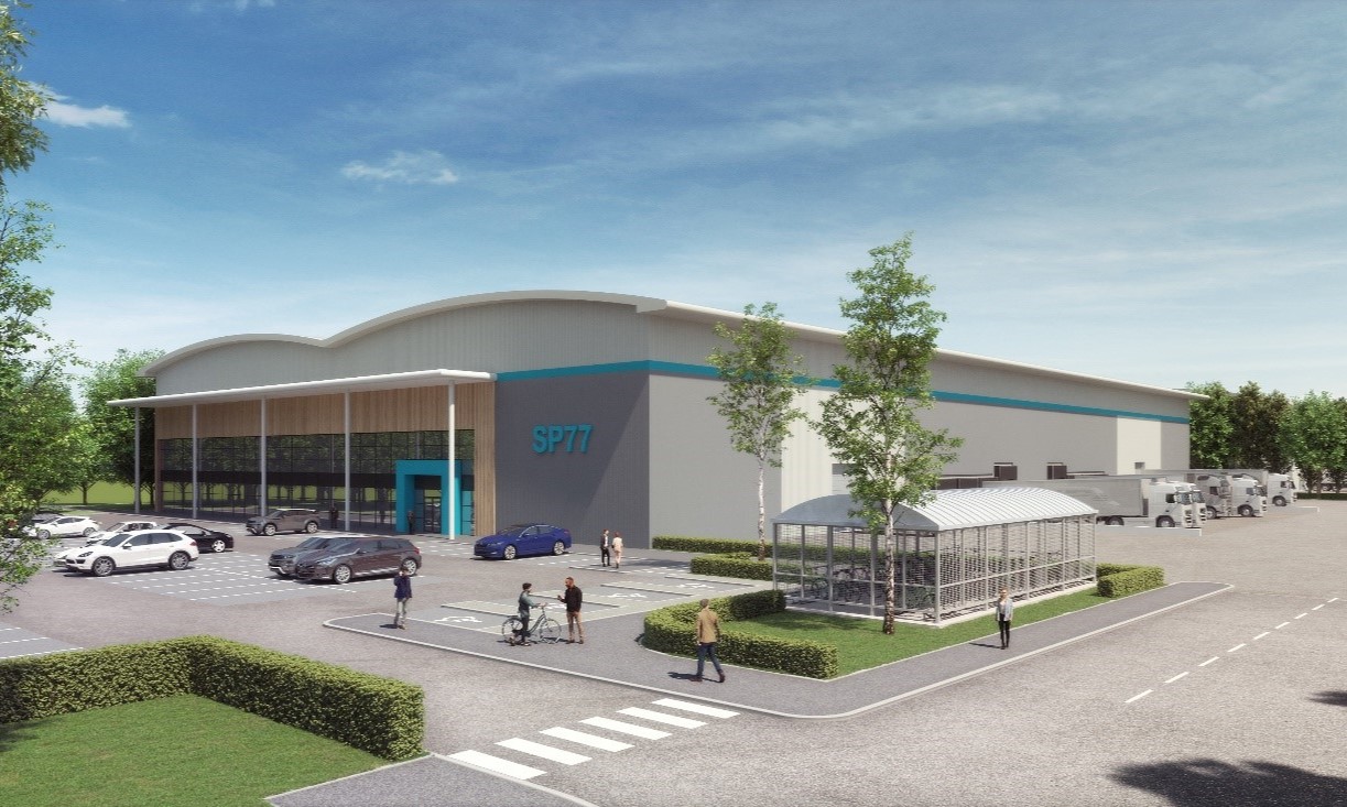
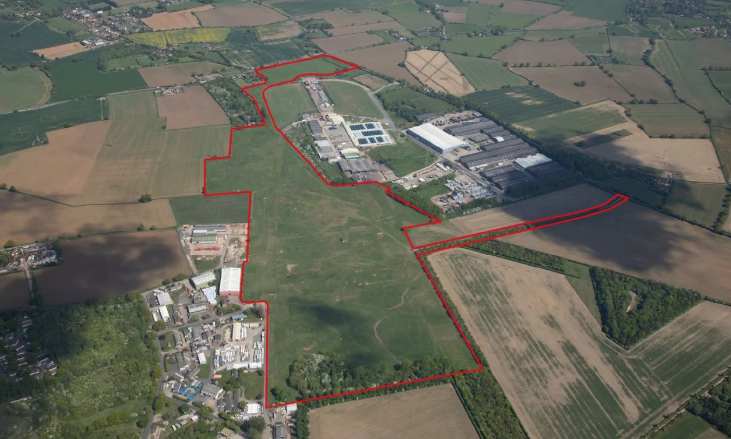
SP 77, Suffolk Park
Bury St Edmunds, Suffolk
Download SP 77 –
Suffolk Park PDF
Suffolk
Business Park
Bury St Edmunds, Suffolk
Visit Church Manor Website – Suffolk Business Park
Plot 200, Haverhill Research Park
Download
Plot 200 PDF
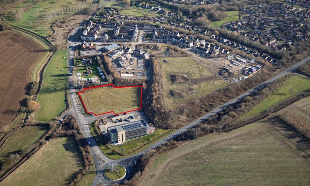
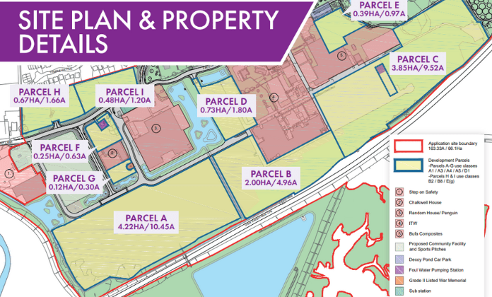
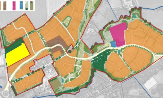
Hatchfield Farm
Newmarket, Suffolk
Download Hatchfield Farm Masterplan PDF
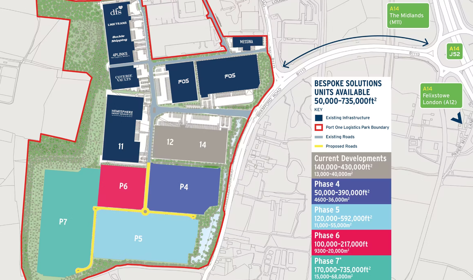
Port One
Download
Port One PDF
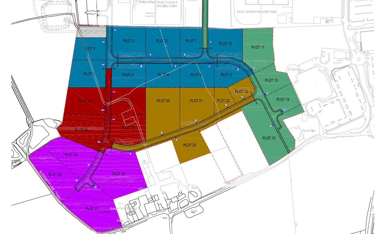
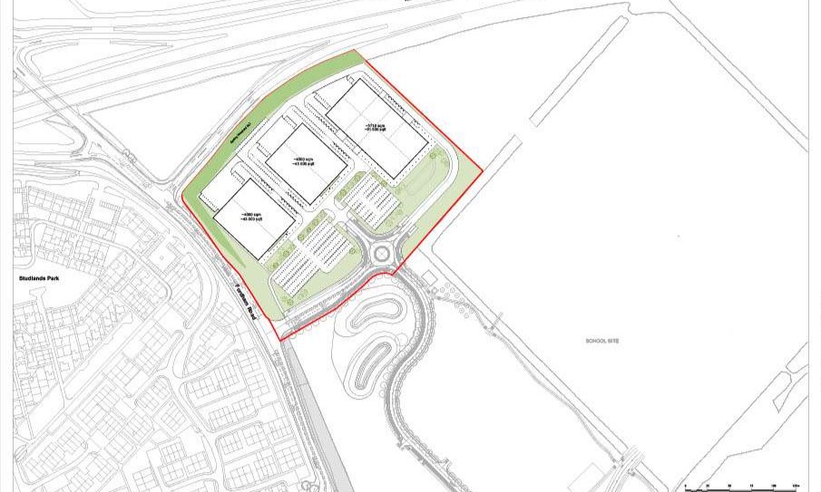
Gateway 14
Download
Gateway 14 PDF
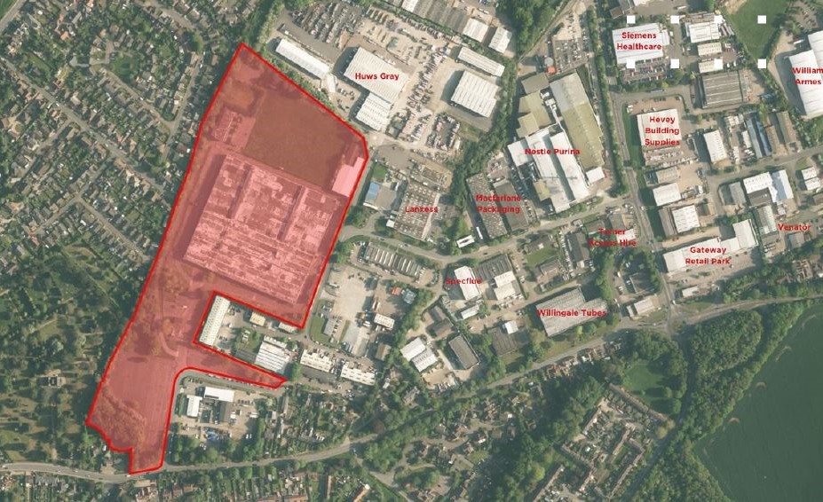
Former Delphi Site
Visit Savills Website
– Former Delphi Site
Brantham
Industrial Area
Download
Brantham PDF
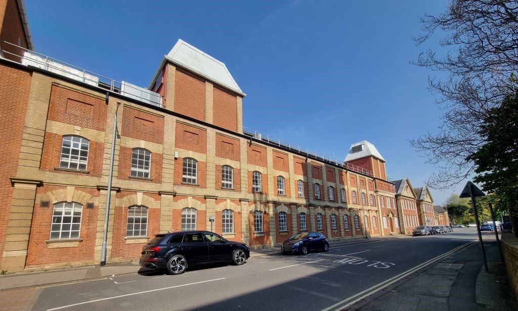
Former Bosch Site, Suffolk Works
Visit Bidwells Website
– Former Bosch Site
Former Vanners Site, Gregory Mills
Visit G M
Carehome Website
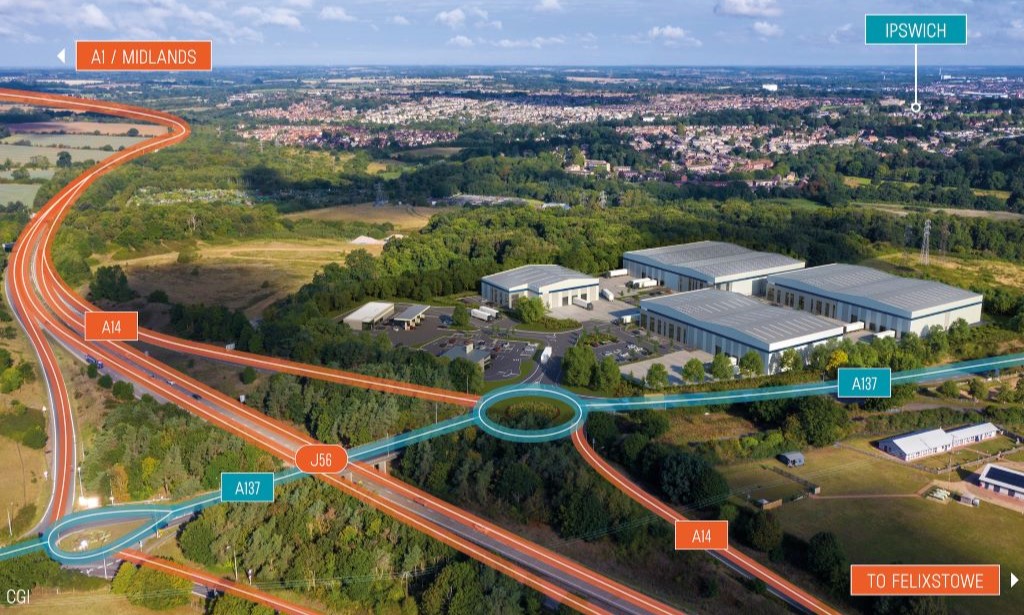
Junction 56
Download
Junction 56 PDF
Interchange 55
Ipswich, Suffolk
Visit Interchange 55 Website
4 Star Hotel Development
Ipswich, Suffolk
Visit Invest Ipswich Website – Hotel
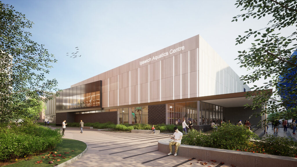
Aquatics Centre
Visit Invest
Ipswich Website
– Aquatics Centre
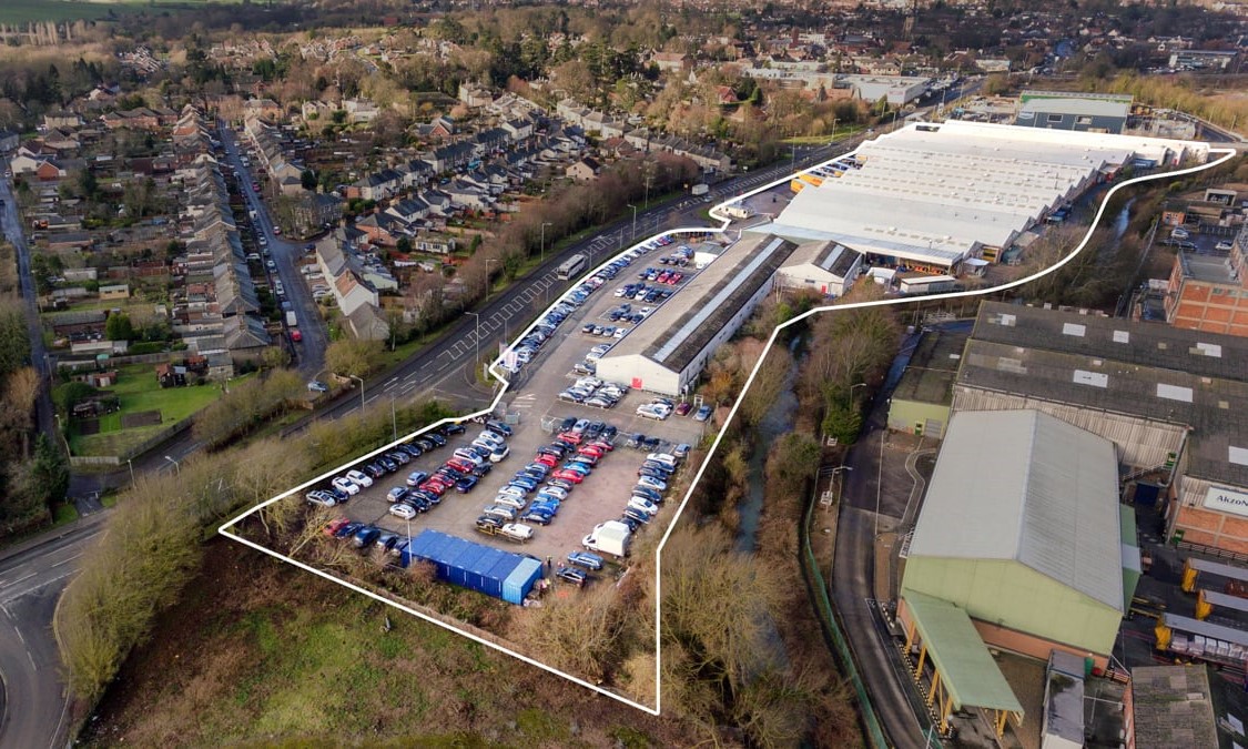
New Way Industrial Development
Ipswich, Suffolk
Visit Invest Ipswich Website – New Way
Multistorey Car Park Development
Ipswich, Suffolk
Visit Invest Ipswich Website – Multistorey
Grafton House
Ipswich, Suffolk
Visit Invest Ipswich Website – Grafton House
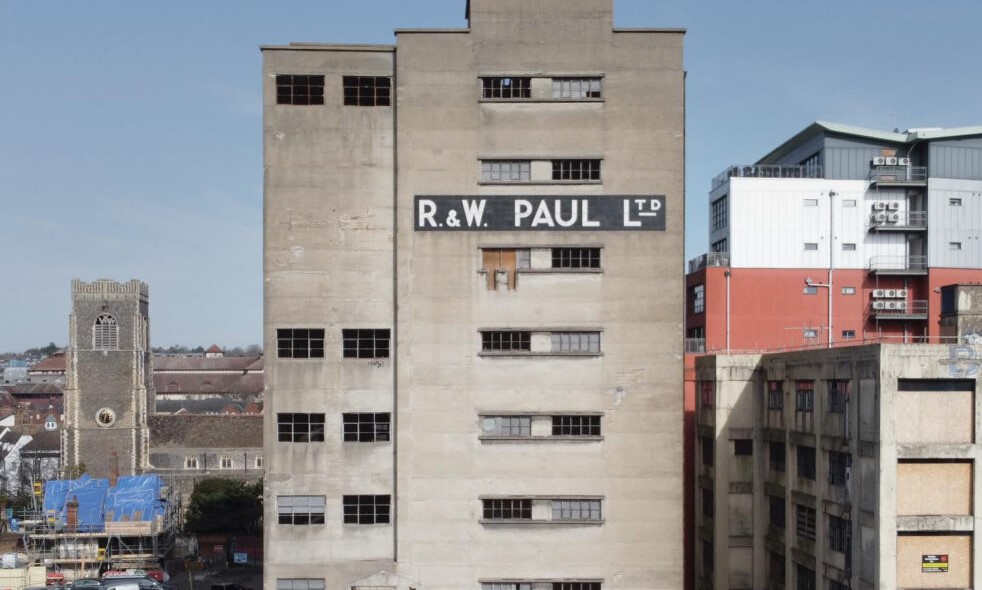
Paul's Silo
Ipswich, Suffolk
Visit Invest Ipswich Website – Paul’s Silo
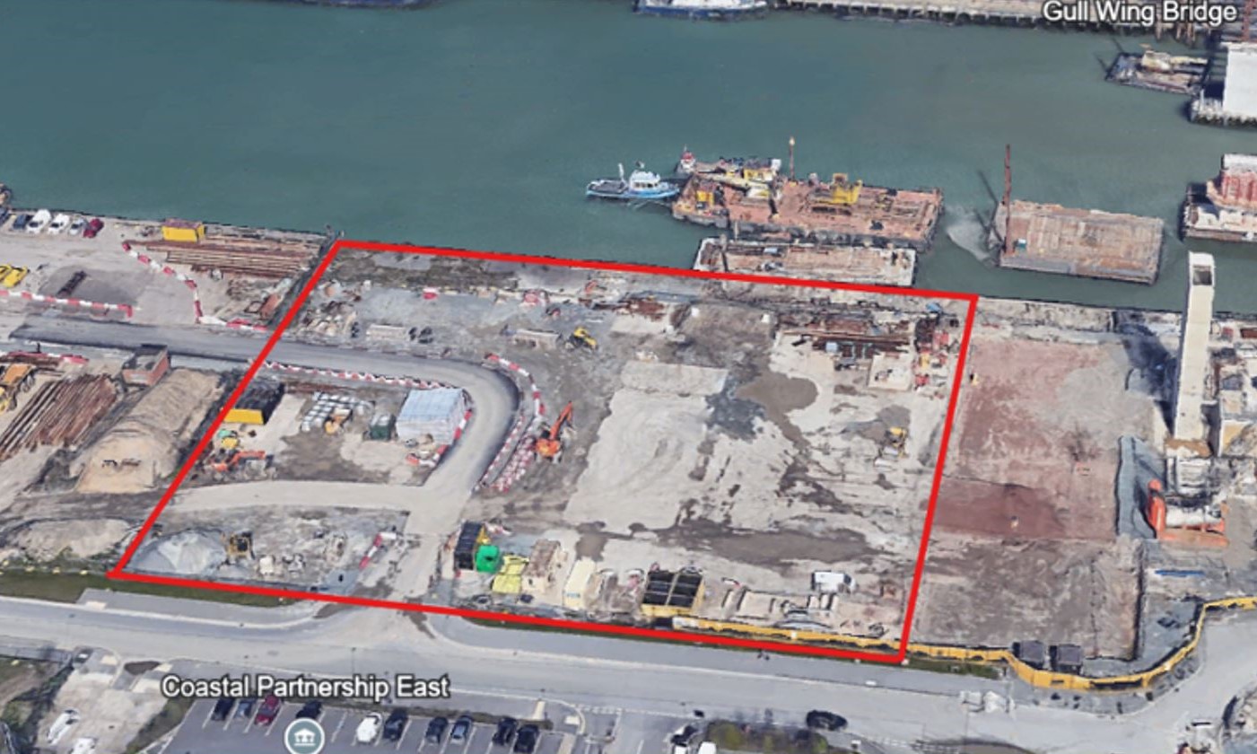
Port Of Lowestoft,
1 Commercial Road
Download
1 Commercial Rd PDF
Bury Road Site
Download Bury Rd
Plan PDF

Former School Site
Download Former
School Plan PDF
Former Archive
Download Archive
Plan PDF
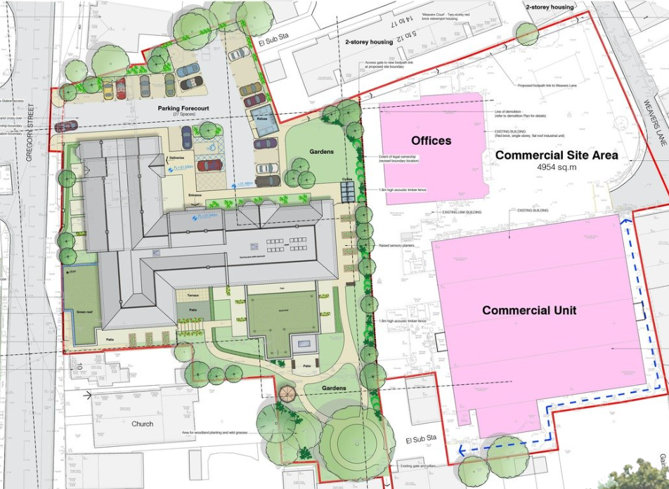
Ipswich
Community Assets
Download Ipswich
Community Plan PDF
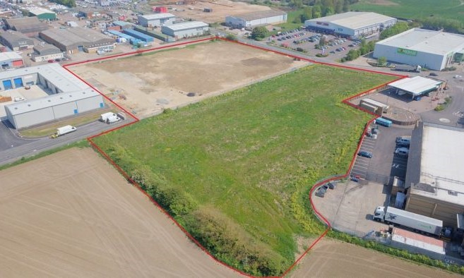
Rougham Hill
Land
Bury St Edmunds, Suffolk
Download Rougham
Hill Plan PDF
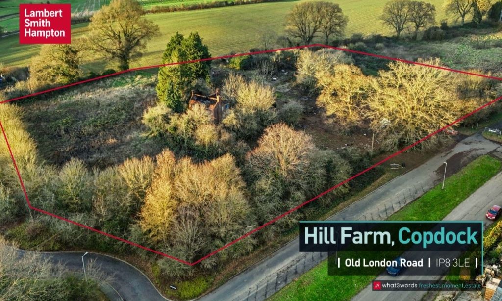
Hill Farm
Development Land
Ipswich, Suffolk
Download
Hill Farm PDF
Constantine House
Ipswich, Suffolk
Download Constantine
House Plan PDF